Miramichi Fishing Report for Thursday, July 16, 2015
The big news this week is the weather with the early part of this week being a scorcher. As a result, fishing slowed almost to a stop as the water warmed and dropped to low levels. A bit of rain Wednesday was welcome, but it was only a drop when buckets are needed.
[wp_bannerize group=”doug1″]
This caused DFO to basically close all cold water pools on Tuesday as per follows:
Notice to Recreational Anglers Fisheries and Oceans Canada Gulf Region
Salmon angling on the Miramichi River system
Moncton – July 14, 2015 – Fisheries and Oceans Canada wishes to inform the public that the following salmon fishing pools will be closed to angling for all species of fish, for cause of high water temperature and low water levels. These changes are effective as of Tuesday, July 14, 2015:
- The waters of the Northwest Miramichi River to a point 100 meters off the shore from 50 meters upstream to 100 meters downstream of the mouth of Wildcat Brook, and including the waters of Wildcat Brook 50 meters upstream of its mouth;
- The waters of the Northwest Miramichi River to a point 100 meters off the shore from 50 meters upstream to 100 meters downstream of the mouth of Trout Brook, and including the waters of Trout Brook 50 meters upstream of its mouth;
- Waters of the Little Southwest Miramichi River to a point 100 meters off the shore from 50 meters upstream to 100 meters downstream of the mouth of Harris Brook, and including the waters of Harris Brook 50 meters upstream of its mouth;
- Waters of the Little Southwest Miramichi River to a point 100 meters off the shore from 50 meters upstream to 100 meters downstream of the mouth of Parks Brook, and including the waters of Parks Brook 50 meters upstream of its mouth;
- The waters of the Southwest Miramichi River to a point 100 meters off shore from 50 meters upstream to 100 meters downstream of the mouth Gray Rapids Brook, and the waters of Gray Rapids upstream from its confluence with the Southwest Miramichi River to Route 118, an area locally known as Pete’s Brook;
- The waters of the Southwest Miramichi River to a point 100 meters off shore from 50 meters upstream to 100 meters downstream of the mouth of Hudson Brook, and including the waters of Hudson Brook 50 meters upstream of its mouth;
- The waters of the Southwest Miramichi River to a point 100 meters off shore from 50 meters upstream to 200 meters downstream of the mouth of Bartholomew River, and the waters of Bartholomew River upstream from its confluence with the Southwest Miramichi River to Highway #8;
- The waters of the Southwest Miramichi River to a point 100 meters off the shore from 50 meters upstream to 100 meters downstream of the mouth of Mersereau Brook, and including the waters of Mersereau Brook 50 meters upstream of its mouth;
- The waters of the Southwest Miramichi River to a point 100 meters off shore from 50 meters upstream to 100 meters downstream of the mouth of Morse Brook, and the waters of Morse Brook upstream from its confluence with the Southwest Miramichi River to Howard Road;
- The waters of the Southwest Miramichi River to a point 100 meters off the shore from 50 meters upstream to 100 meters downstream of the mouth of McKenzie Brook, and including the waters of McKenzie Brook 50 meters upstream of its mouth;
- The waters of the Southwest Miramichi River to a point 200 meters off shore from 50 meters upstream to 100 meters downstream of the mouth of Black Brook, and the waters of Black Brook upstream from its confluence with the Southwest Miramichi River to South Cains River Road;
- The waters of the Southwest Miramichi River to a point 100 meters off shore from 50 meters upstream to 300 meters downstream of the mouth of Donnelly Brook, and the waters of Donnelly Brook upstream from its confluence with the Southwest Miramichi River to the South Road Bridge;
- The waters of the Southwest Miramichi River, 100 meters downstream of the mouth of Mill Brook to a line drawn from grid reference 19T 728610E 5162685N to grid reference 19T 728621E 5162548N up to 50 meters upstream of the mouth of the said brook to a line drawn from grid reference 19T 728392E 5162687N to grid reference 19T 728380E 5162400N;
- The waters of the Southwest Miramichi River, 100 meters downstream of the mouth of Big Hole Brook to a line drawn from grid reference 19T 716331E 5158713N to grid reference 19T 716324E 5158601N up to 50 meters upstream of the mouth of the said brook to a line drawn from grid reference 19T 716067E 5158724N to grid reference 19T 716116E 5158558N;
- The waters of the Southwest Miramichi River to a point 200 meters off shore from 50 meters upstream to 300 meters downstream of the mouth of Betts Mills Brook, and the waters of Betts Mills Brook upstream from its confluence with the Southwest Miramichi River to Highway # 8;
- The waters of the Southwest Miramichi River to a point 100 meters off shore from 50 meters upstream to 100 meters downstream of the mouth of Porcupine Brook, and the waters of Porcupine Brook upstream from its confluence with the Southwest Miramichi River to Storeytown Road;
- The waters of the Renous River to a point 100 meters off shore from 50 meters upstream to 100 meters downstream of the pump house located at grid reference 20T 285909E 5187384N;
- The waters of the Renous River to a point 100 meters off the shore from 50 meters upstream to 100 meters downstream of the mouth of Butty’s Brook, and upstream from its confluence with the Renous River to South Renous River Road, an area locally known as Duffy’s Brook;
- The waters of the Cains River, 100 meters downstream of the mouth of Otter Brook to a line drawn from grid reference 20T 288745E 5169162N to grid reference 20T 288721E 5169075N up to 50 meters upstream of the mouth of the said brook to a line drawn from grid reference 20T 289000E 5169261N to grid reference 20T 289068E 5169198N, and including the waters of Otter Brook 50 meters upstream of its mouth, an area locally known as Brophy’s Place;
- The waters of the Cains River to a point 100 meters off the shore from 50 meters upstream to 100 meters downstream of the mouth of Cold Brook, including the waters of Cold Brook 50 meters upstream of its mouth;
- The waters of the Cains River, 300 meters downstream of the mouth of Salmon Brook to a line drawn from grid reference 20T 292350E 5165039N to grid reference 20T 292465E 5165054N up to 50 meters upstream of the mouth of the said brook to a line drawn from grid reference 20T 292311E 5164868N to grid reference 20T 292424E 5164798N, and the waters of Salmon Brook upstream from its confluence with the Cains River to South Cains River Road at grid reference point 20T 292771E 5164988N;
- The waters of the Cains River to a point 100 meters off the shore from 50 meters upstream to 100 meters downstream of the mouth of Muzeroll Brook, and including the waters of Muzeroll Brook 50 meters upstream of its mouth; and
- The waters of the Cains River to a point 100 meters off the shore from 50 meters upstream to 100 meters downstream of the mouth of Six Mile Brook, and including the waters of Six Mile Brook 50 meters upstream of its mouth;
Please note that the following salmon harvesting pools will remain closed until December 31, 2015:
- The waters of the Northwest Miramichi River inside a line drawn from a point on land at grid reference 285336E 5202332N located approximately 100 meters upstream from the mouth of Sutherland Brook, then across to the north side of the river at grid reference 285560E 5202535N then downstream from grid reference 285719E 5202415N to grid reference 285505E 5202205N located approximately 100 meters downstream from the mouth of Sutherland Brook and Sutherland Brook upstream to the highway 420 bridge;
- The waters of the north side of the Southwest Miramichi River inside a line drawn from a point on land at grid reference 298589E 5196806N located approximately 100 meters downstream from Wilson Brook, southward to grid reference 298667E 5196744N and upstream to grid reference 298518E 5196616N and northward to grid reference 298437E 5196676N located on land approximately 100 meters upstream from Wilson Brook and including the waters of Wilson Brook upstream 100 meters of its mouth, an area locally known as the Bear Den; and
- The waters of the Southwest Miramichi River inside a line drawn from a point on land at grid reference 287787E 5189991N located approximately 300 meters downstream from Quarryville Bridge across to the north side of the river at grid reference 287692E 5190123N upstream to grid reference 287239E 5189734N and to grid reference 287361E 5189590N located approximately 300 meters upstream from Quarryville Bridge and Indian Town Brook upstream to highway 108 bridge;
All geographical coordinates are expressed in North American Datum 1983 (NAD 1983).
To report any suspicious fishing activity, please contact the nearest Conservation and Protection detachment in the Gulf Region or call Crime Stoppers at 1-800-222-8477.
For more information on this fishery, please contact:
Pierre Bélanger
Senior Advisor, Recreational Fisheries
Fisheries and Oceans Canada
Moncton, NB
(506) 851-2002
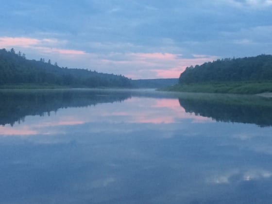
The Main Southwest Miramichi River above Doaktown. Photo by Derek Munn.
Doug White’s Tammerack Sports Fly Shop in Juniper said there “wasn’t much going on here, don’t know if there are fish or not as there is nobody out. You might say it’s a bit quiet.”
W. W. Doak and Sons in Doaktown said there were decent numbers of fish in the system, but they were not taking as the water was low and warm. Most of the fish were pooled up. Both the Dungarvon and Renous were quite low and warm. A good rain is needed.
Flies of choice were Same-Thing-Murrays, Undertakers and White-tailed Green Machines on nos. 8 & 10 hooks, along with Dry Flies and Bombers.
Derek Munn of Ledges Inn in Doaktown and Mountain Channel in the Rapids area said fishing had been good until Saturday with anglers catching a good mix of salmon and grilse. Since then the water has warmed considerably and is low. The water temperature was in the high 70s Fahrenheit early this week and a good rain is needed. Temperatures are supposed to be a bit cooler as we enter the weekend, so that is a positive.
Flies of choice were mostly Bombers and small dark flies such as Undertakers on nos. 8 & 10 hooks.
Herb Barry Sr. of Herb’s Fly Shop on the Station Road in Blackville said anglers were seeing some fish, but most were just laying there and not taking because the water was low and warm. He felt that there weren’t hordes of fish in the river, but rather decent pockets here and there.
Flies of choice were Red Squirrel-Tails with green butts, Green-butt Bear Hairs, Green Rats, White-tailed Green Machines and Same-Thing-Murrays on smaller hooks.
Curtis Miramichi River Outfitting in Blackville said there were good numbers of fish around, but because the water was low and very warm very few were taking a fly. Canoeing conditions were very good.
Flies of choice were White-tailed Green Machines, Shady Ladies, Same-Thing-Murrays, Picasse (black & yellow), Green Highlanders and Carter’s Bugs.
George Routledge of George’s Fly Shop at the Mouth of Renous in Quarryville said there were quite a few fish in the river, but the water was warm and low, and certainly not good for the fish. He said he would not be surprised to see some go belly-up. Rain is badly needed.
Flies of choice were Shady Ladies, White-tailed Green Machines, Black Ghosts and Same-Thing-Murrays on no. 10 hooks, along with Dry Flies and Bombers.
Jim Laws of Miramichi Hunting and Fishing in Newcastle, Miramichi reported the odd fish being hooked, and some trout in different spots. But there was no great amount of fish to speak of. The Striped Bass are gone from this area for the summer. Water conditions were very warm and low.
Flies of choice were Blue Rats, Blue Charms and White-tailed Green Machines early in the morning, and Dry Flies and Bombers (Green with white wings) later in the day.
Syd Matchett of Trout Brook Fly Shop on the Northwest Miramichi said the water was low and warm, but still, a couple were caught Tuesday morning. But generally there were very few anglers out. A good day’s rain would be most welcome.
Flies of choice were mostly Dry Flies and Bombers along with Shady Ladies, Undertakers, Green –butt Bear Hairs and Green-butt Squirrel Tails on nos. 8 & 10 hooks.
Debbie Norton of Upper Oxbow Outdoor Adventures on the Little Southwest Miramichi said they were doing reasonably well until the heat hit on Saturday. Rina Chase of Grotten, New Hampshire hooked a nice salmon covered with sea-lice on Saturday using a small green bug. Anglers were seeing fish, but they were not taking. One of her sports said that he was seeing more fish than he did last year.
Flies of choice were Walts, Undertakers, small green bugs and White-tailed Green Machines.
Hopefully better temperatures and maybe some rain will flip the switch to catching once again. Then we can get out and “on the water”.
Don’t forget to show your support for our sponsors, because without them, this column would not be possible.
Check out Deals 4 U in Miramichi for your grocery needs, and good Cuban cigars to celebrate getting back to the rivers. Drop by Mac’s Seafood Market to get fresh-cooked lobster and all your seafood needs!
[wp_bannerize group=”doug7″]
ANY FINANCIAL CONTRIBUTIONS TOWARD HELPING WITH THIS COLUMN ARE GREATLY APPRECIATED. Click here to donate now. A SPECIAL THANKS to all who made contributions last season.
If you would like to sponsor this column, give us a call at (506) 352-7668 or email .
Thought for the Week: “Don’t tell fish stories where the people know you; but particularly, don’t tell them where they know the fish.” ~Mark Twain
E-MAIL:
Good Morning Mr. Underhill.
This past Saturday evening, I was fishing Greasy Island Pool on the Renous. We had parked the truck down in the ditch just past the 150 mile marker and walked through the bog down to the pool. Monday I was sorting through my gear, and washing my waders, when I realized I didn’t have my Sling pack with some gear in it! I’ve looked everywhere and the best I can figure is I set it on the back of the truck while taking my waders off, and left it there.
Other then a few small gadgets and my license, here is what is in it:
• SIMMS sling pack
• Lamson Guru 3.5 reel
• Oakley Flak Jacket sunglasses
• Columbia rain coat (green)
I am wondering if you could put a note in your newsletter, I am offering $100 reward for its safe return!
My cell is 506-381-1065
Much Appreciated!
Matt Weir, PG Pro™
Phone: 506-383-9998
Toll Free: 1-855-860-7812
Email:
————————————————————-

George Routledge Citizen Appreciation Night
A Citizen Appreciation Night for George Routledge will be held on Saturday, July 18 at 6:00pm at Saint Andrews United Church Center in Blackville. A cold buffet will be served. The Sutton Brook Singers will provide entertainment for the evening. Tickets are $20 and are available at Circle K Irving in Blackville, Route 118 Convenience in Renous, Renous Convenience or by calling Marsha at 843-2525 or Joy at 622-6704. Click here for more details.
————————————————————-
Atlantic Salmon Federation News
Friday, July 10, 2015
ASF RIVERNOTES – Summer Heat Slows Activity
~~~~~~~~~~~~~~~~~~~~~~~~~~~~~~~~~~~~~~~~~~~~~~~~
In some areas the arrival of summer is slowing Atlantic salmon activity. Meanwhile, overall, numbers seem better than last year, but this isn’t true everywhere. Read more.
http://atlanticsalmonfederation.org/rivernotes/
ASF Research Blog – ASF’s pioneering research in tracking has included use of satellite tags. Even after they “pop off” and transmit to a satellite, they are telling a story. One drifted into Disko Bay, Greenland. Read more.
http://asf.ca/research-in-the-field.html
Thirteen Seconds of WOW!
~~~~~~~~~~~~~~~~~~~~~~~~~~~~~~~~~~~~~~~~~~~~~~~~
ASF put up on its Facebook page this week a contributed short video of a salmon leaping on the Moisie River. So far it has reached 425,000 people and has a total of 153,000 views – and is still going strong.
https://www.facebook.com/AtlanticSalmonFederation
Swim with Wild Atlantic Salmon
~~~~~~~~~~~~~~~~~~~~~~~~~~~~~~~~~~~~~~~~~~~~~~~~
Fundy National Park is offering a very special program where visitors are led on a swim through a stream where Atlantic salmon are also swimming. A great opportunity!
http://www.pc.gc.ca/eng/pn-np/nb/fundy/activ/vedette-featured/saumon-salmon.aspx
Visit the Wild Salmon Nature Centre
~~~~~~~~~~~~~~~~~~~~~~~~~~~~~~~~~~~~~~~~~~~~~~~~
ASF offers a unique opportunity to learn about Atlantic salmon, ASF’s research, and the heritage of Atlantic salmon at its Wild Salmon Nature Centre in St. Andrews. For more info:
http://wildsalmonnaturecentre.ca/
Chasing Poachers in NL
~~~~~~~~~~~~~~~~~~~~~~~~~~~~~~~~~~~~~~~~~~~~~~~~
Two men have been charged with netting salmon in Gander Lake, with a canoe and other gear seized. Read more
http://asf.ca/salmon-poaching-in-gander-lake-leads-to-foot-chase-arrests.html
Until next week
TIGHT LINES
DOUG
Giv’er Miramichi is about “What’s up, what’s new, what’s happening”. We are focused on building people up, supporting one another and celebrating our successes.